
Subscribe
Take a Step Towards Climate Justice in Seattle.
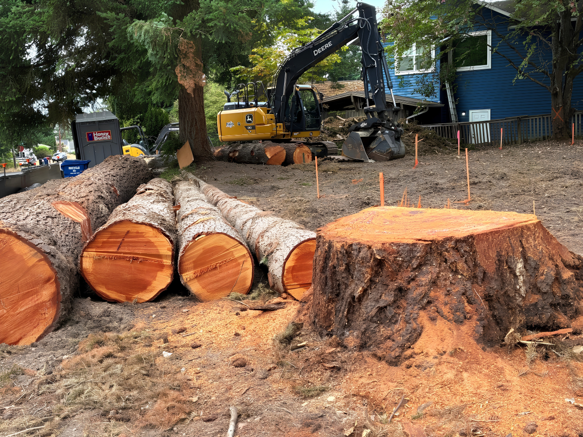

Seattle has some of the worst tree protections in the country — with policies that promote massive tree loss in neighborhoods and prioritize private profit over public health and the environment.
To understand how we got here, we filed multiple public records requests about Seattle’s 2021 canopy study, which is the central story Seattle tells residents about the health of its trees. We found a trail of misinformation and buried data. Here’s every shocking thing we learned, with receipts.
The City hired a University of Vermont geospatial team for its 2021 canopy study, then hired a separate consulting firm to help with “strategic messaging” for the final report.1
The result? Seattle taxpayers paid twice for a tree canopy assessment riddled with misinformation and false narratives.
These narratives are proliferated by all levels of city government, who have been using the 2021 study 2 as a guiding document for urban forest policy since its release. Here’s an overview of the biggest problems we identified with Seattle’s 2021 canopy assessment:
1: Development and bad land use policy are the hidden root cause of tree loss in our city
The University of Vermont geospatial mapping firm that the city originally hired for the canopy assessment wrote in their final document that zoning and redevelopment was a primary driver of tree loss, and that the city should integrate tree canopy assessments into zoning and land use decisions.3 KUOW reported that between 2016 and 2021 development accounted for 94% of tree removals in the city. Instead of including these findings in the canopy assessment, the city ditched the University of Vermont experts and hired Cascadia consultants to help finalize the assessment and define the report’s “desired messaging” 1 (page 9).
In direct contradiction to the University of Vermont findings and with no scientific evidence, the city’s canopy assessment claimed that climate conditions and pests were primary drivers of tree loss, and included the patently false statement that “most of the (870 acres of) trees lost in Neighborhood Residential were likely lost for reasons other than development” 2 (page 36).
The methodology used to measure development in the city’s final assessment had a built-in undercount: they only counted a parcel as "redeveloped" if construction both started and finished within the 2017–2021 window. A project still under construction when the study period ended (including anything delayed by the Covid pandemic) got counted as “not redeveloped" by the city, even if significant demolition or construction activity took place during the study window.
An independent analysis by Oregon State graduate researcher Theodore Hoss, using Seattle building permit data, found that more than 93% of canopy decline on city parcels occurred on parcels with active permits.4
2: Counting invasive Himalayan blackberry as tree canopy.
Invasive blackberry thickets are erroneously counted as canopy because the city measured tree canopy at an 8-foot threshold instead of using the more accurate and widely-accepted threshold of 10-12 feet.
This means that the restoration work of clearing blackberry in parks counted as canopy loss for parks, and invasive blackberry growth in the public right of way and on private property counted toward canopy gain in those areas.
3: Promoting a false narrative about canopy loss in parks.
Much of the restoration work happening in parks shows up as a net loss in tree cover, even when it makes ecosystems healthier. For example, clearing tall thickets of blackberry shows up as canopy loss due to the low 8-foot threshold. Ecological thinning, which promotes overall forest health, results in canopy reduction but generates a healthier forest system. And trees falling for beaver dams in riparian corridors look like tree loss, but are actually a healthy and natural part of those ecosystems.
We personally hear council members say over and over again that “our biggest tree losses are in parks” while pushing forward legislation that allows for massive tree losses on residential lots and in the public right of way, removing canopy where it’s needed most.
4: Spreading misinformation about the relationship between trees and extreme heat.
The city’s canopy report erroneously claims that tree canopy makes only a “1-degree difference in temperature on hot days” 2 (page 27). This contradicts settled science from NOAA, the USGS and even the King County Heat Mapping project, which all find that tree canopy produces much greater cooling benefits, from 7 to 20 degrees.
We obtained emails showing that, just days before the report went to final reviewers, a manager directed staff to change the heat numbers.5 We don’t know what the numbers were or why they changed them, but we do know that “1 degree of cooling” grossly understates the devastating heat impacts of low canopy in our most vulnerable frontline communities.
5: Canopy volume data was asked for, collected, paid for, but never released.
As part of the 2021 study, Seattle paid the University of Vermont to measure canopy volume; i.e. how much actual leaf and branch mass is up there.6 This gives a more accurate picture of total urban canopy than measurements at the 8-foot level.
Canopy volume did not make it into the published report. When city staff were pressed to release it at three Urban Forestry Commission meetings in 2023, they said it was “still being analyzed.”
However, city staff already knew Seattle’s tree canopy volume was getting shallower, even in areas where canopy area held steady. We’ve all seen it: massive native conifers and giant healthy maples and oaks cut down and “replaced” with tiny ornamental trees that die soon after they’re planted.
An internal 2017 study by SDCI states “Conifers and large tree species are being removed, and deciduous and dwarf species are being planted.” The volume data which might have shed light on that trend was never published by the city. 7
The city had the data that showed that most tree loss was tied to development and bad land use policy way back in 2021.
Instead of correcting themselves, city leadership hid information from the public and doubled down on false narratives; handing their constituents a tree ordinance riddled with loopholes for developers and a comprehensive plan that allows up to 99%+ of residential lots to be hardscape (i.e., less than 1% greenspace or open soil).8
² The city's final 2021 canopy assessment (with "strategic messaging")
⁶ The contract and scope of work between the City and the University of Vermont researchers
⁷ The 2017 Internal SDCI report on tree canopy volume
⁸ Calculation for greenspace from Seattle's Phase 1 Comprehensive Plan (source: SMC 23.44.120). There is no general greenspace requirement for Neighborhood Residential-zoned lots in Seattle.
Assuming a standard 5,000 SF residential lot:




.png)